Table of Contents
Forest fire plays a major role in the degradation of the forest area and extremely difficult to control. It affects the essential factors such as climate, water cycle, the habitat of thousands of life forms and the whole environmental ecosystem. Forest is the large land area covered by trees with different heights and density, shrubs, grasses, vegetation, agricultural plants, and more species.
One of the easiest ways to study forest fires is Remote sensing and GIS techniques. It ha become more predominate, that more satellites now study earth’s behavior and simultaneously provides images of the earth. This is how we will be able to extract information about the forest such as forest fires, causes of the fire, types of forest fire, forest-covered areas, assessment of forest fires, type of forest fire occurred, estimation of forest fire burned areas and so on. This is where remote sensing is used to detect forest fires.
What is causes Forest Fire?
There are two causes of a forest fire that are natural causes and manmade causes.
Natural causes
Lightning is the natural cause of forest fires. Lightning fires cause more damage to the forest. This is because lighting fires occur in remote areas which far from human presence, unlike fires caused by human activities. Volcanic eruptions, mountain slopes, and lava flow can cause fires that are difficult to put out because of other associated risks.
Man-Made causes
Human activities near or within forest areas are the foremost cause of forest fires. Smoking near vegetation can cause a widespread fire when a smoker throws a cigarette into vegetation without completely extinguishing its burning butt. While most smokers throw lit cigarettes innocently, their actions have caused several forest fires throughout history.
Equipment such as machinery used in logging and hunting can also cause fires. Bullets hitting on some dry vegetation, petroleum products used in logging equipment can cause fires when there is a leak onto the vegetation. Other causes include campfires that are not well monitored or put off entirely. Electric faults from facilities or electricity plants near forests can also cause fires. In some extreme cases, people have deliberately caused fires during hunting to corner wild animals while others burn forests to clear the way for agriculture or development activities.
Damages
Forest fires or deforestation results in degradation, soil erosion, air pollution, loss of lives of wildlife species and there are more.
Types of Forest fire
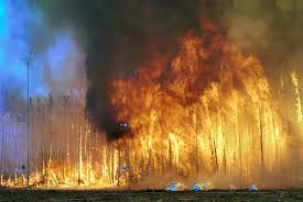
Fire
It is the type of fire known as the trees that burn up their entire length to the top. These are the type of crown fires most dangerous wildland fires.
Surface Fire
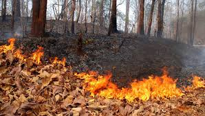
It is the type of fire known as burn only surface litter and duff. They are easy to suppress and it causes very little damage to the forest.
Ground Fire
This type of fire occurs in deep accumulations of humus, peat and similar dead vegetation which has become dry enough to burn. These types of fire are sometimes called underground or subsurface fires. These fires move slowly but can be difficult to put off.
Especially during prolonged drought, such fires can smolder all winter underground and then emerge at the surface again in spring. It is the type of fire is responsible for opening up canopy gaps.
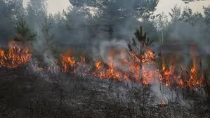
There are types of satellites and instruments are to study forest fires. NASA’s Terra and Aqua satellites and NASA-NOAA’s Suomi NPP satellite provide detailed views of fires and smoke globally up to twice a day. Other satellites like,
- Gravity Recovery and Climate Experiment (GRACE)
- Global Precipitation Measurement mission (GPM)
- Soil Moisture Active Passive or (SMAP)
- Landsat and Sentinel-2 satellite
- Moderate Resolution Imaging Spectrometer (MODIS)
- Visible Infrared Imaging Radiometer Suite (VIIRS)
- ASTER Instrument
- AIRS Instrument
- International Space Station
- MISR
- CALIOP
- MODIS
- MOPITT
- VIIRS
- Aircraft
- AVIRIS
- AVIRIS
- Uninhabited Aerial Vehicle Synthetic Aperture Radar (UAVSAR)
Satellites are used for fire forecasting and risk assessment and Instruments for burned area mapping. Instruments are providing images that are used to monitor and map the dynamic conditions, temporal change earth, forest cover map. ISRO Provides immediate data about forest fires. FSI receives the data about the forest from ISRO. We can receive the forest fire data and map from FSI.
Identification and Mapping of forest fire – Remote Sensing Techniques
Remote sensing techniques play a major role in identity, monitor and map the forest fire burned area. This technique is cost-effective and time-saving.
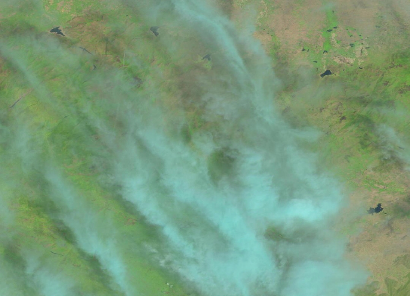
We can identify the active fire from the Satellite images by the direct visual methods. Infrared bands are very useful to find out the access and map the burned areas. We can directly see differences between burned areas and unburned areas. Each feature on the earth has a unique reflectance value.
We can find the forest fires using their reflectance values. The assessment of forest fire and burned areas are done by using the Burn Area Index (BAI), Normalized Burn Ratio (NBR), Mid-Infrared Burn Index (MIRBI), etc. There are also segmentation methods to assess the map and determine the burned area using ENVI or ArcGIS software which also includes supervised and unsupervised classifications.
we can find what type of forest fires occurred by using the forest cover map. These maps are created by using satellite images. The forest cover map consists of dense forest, moderately dense forest, very dense corset, shrub, non-forest, open forest, water bodies.
Pre-fire image of a forest
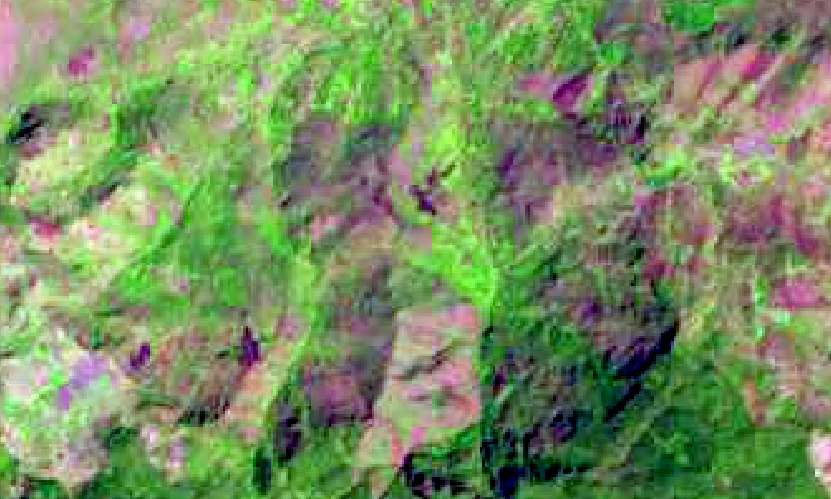
Post-fire image of a forest

Active fire
Conclusion
There are more techniques to assess the forest fire burnt areas and map the pre and post-fire satellite images. Remote sensing is used to detect forest fires by identifying the type with temporal data and Geographic analysis. This process can help you assess the estimation of the burnt areas of the forest, preparing a forest cover map, with different remote sensing techniques.
RELATED POSTS
- Image Classification Techniques in Remote Sensing
- Top 10 Topographic Maps From Around the World
- Geographical Information System (GIS) in Urban Planning
Looking for more? Subscribe to weekly newsletters that can help your stay updated on Geographic Information Systems and Application developments.


